The light blue represents the flow of the beck from Urswick Tarn which
provides the mill with water during the winter.
The dark
blue represents the man made water courses (leats) which take water to
the mill.
Road to Scales Village,
Baycliff, Birkrigg Common and Ulverston
Did you know?
The mill site was established in the 14th , and re-built in the17th
Century.
The web site was established in 1995
Water to power the mill during the summer months is
A shallow glacial
lake filled this valley at the end of the ice age, and many
Mesolithic and Medieval artefacts have been discovered during
the on-going archaeological excavations which have been underway
since 1993.
provided by two springs and a very interesting water course. Water is
taken north from spring 1 (opposite to the natural direction of
flow!), and with water from spring 2, passes through an underground
culvert following the contour to the weir.
No, water does not flow uphill!
Did you know?
A stream or river is known locally as a 'Beck.'
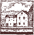
ARCHAEOLOGY
SITE PLAN
of
Gleaston Water Mill
Lile Cottage
Self
catering for 2
"The
Poshest Pig Sty in Cumbria"
Explore the facilities by
clicking a picture or a button,
or scroll north to see the watercourse, archaeology and Gleaston Castle,
.....have fun.
Road to Gleaston Village, Leece and Barrow